
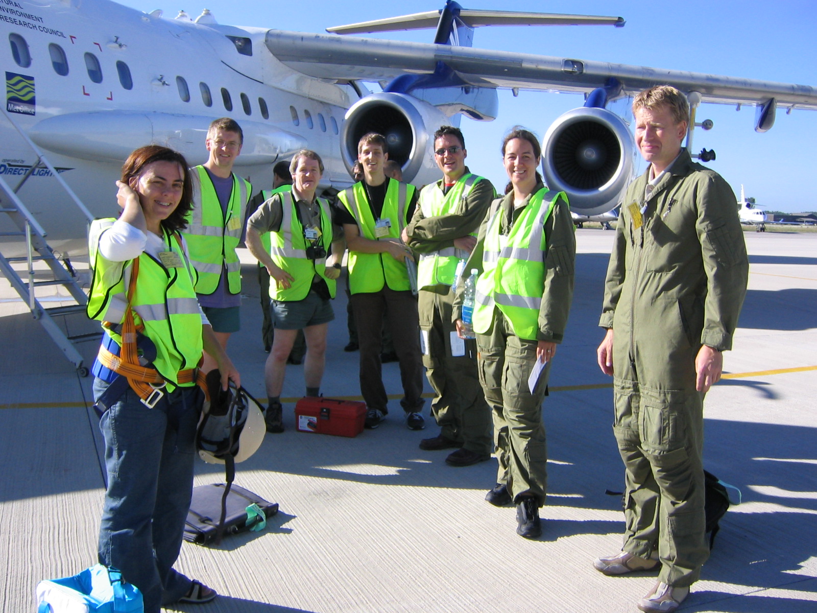
science flights
papers published
projects supported
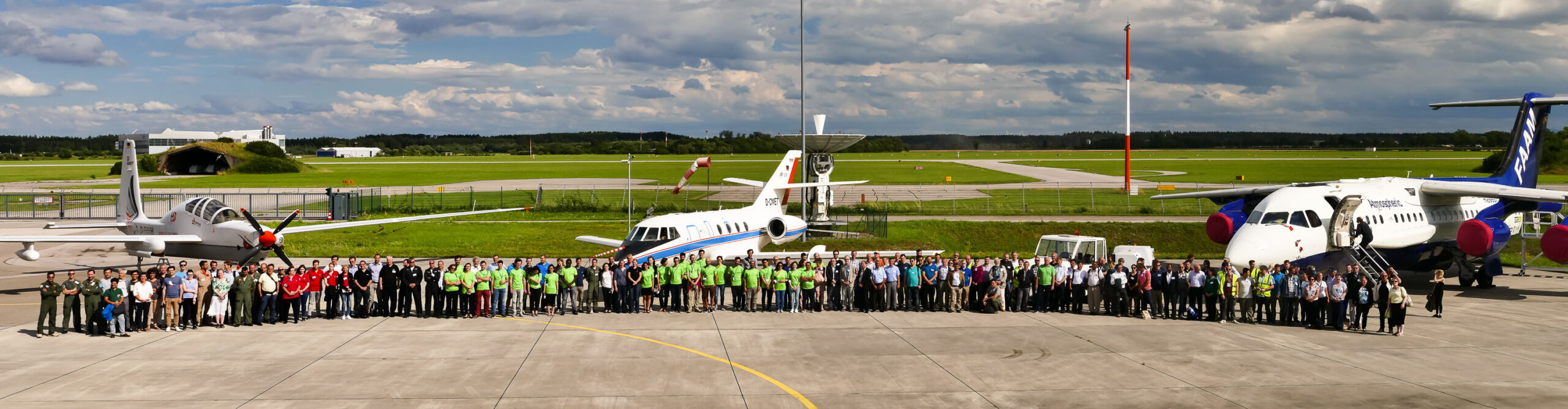
partners
countries
continents
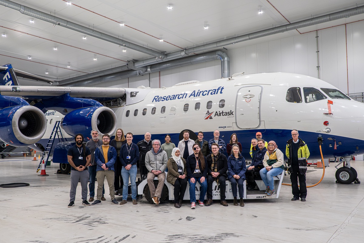
More than two decades of world-leading atmospheric science.
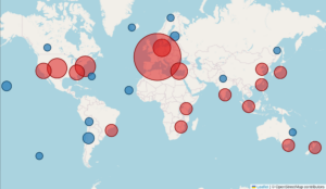
The FAAM Airborne Laboratory has supported over 120 science projects to date, across five continents and more than 30 countries. We have worked with 170 partner organisations globally. Data from FAAM’s measurements have been used in more than 500 publications, several of the world’s largest climate and weather models, and governmental policies both in the UK and internationally.
Our research aircraft sits at the heart of an airborne measurement community that dates back more than 100 years. Beyond the aircraft itself, FAAM and its support partners provide its users with flight operations and campaign support, measurement and instrument expertise, FAIR quality-controlled data, guidance and training. The airborne laboratory is supported by ground-based laboratories, workshops, essential ground power and cooling equipment, and a team of experts that ensure our users can make their measurements their primary focus.


Foundational Research
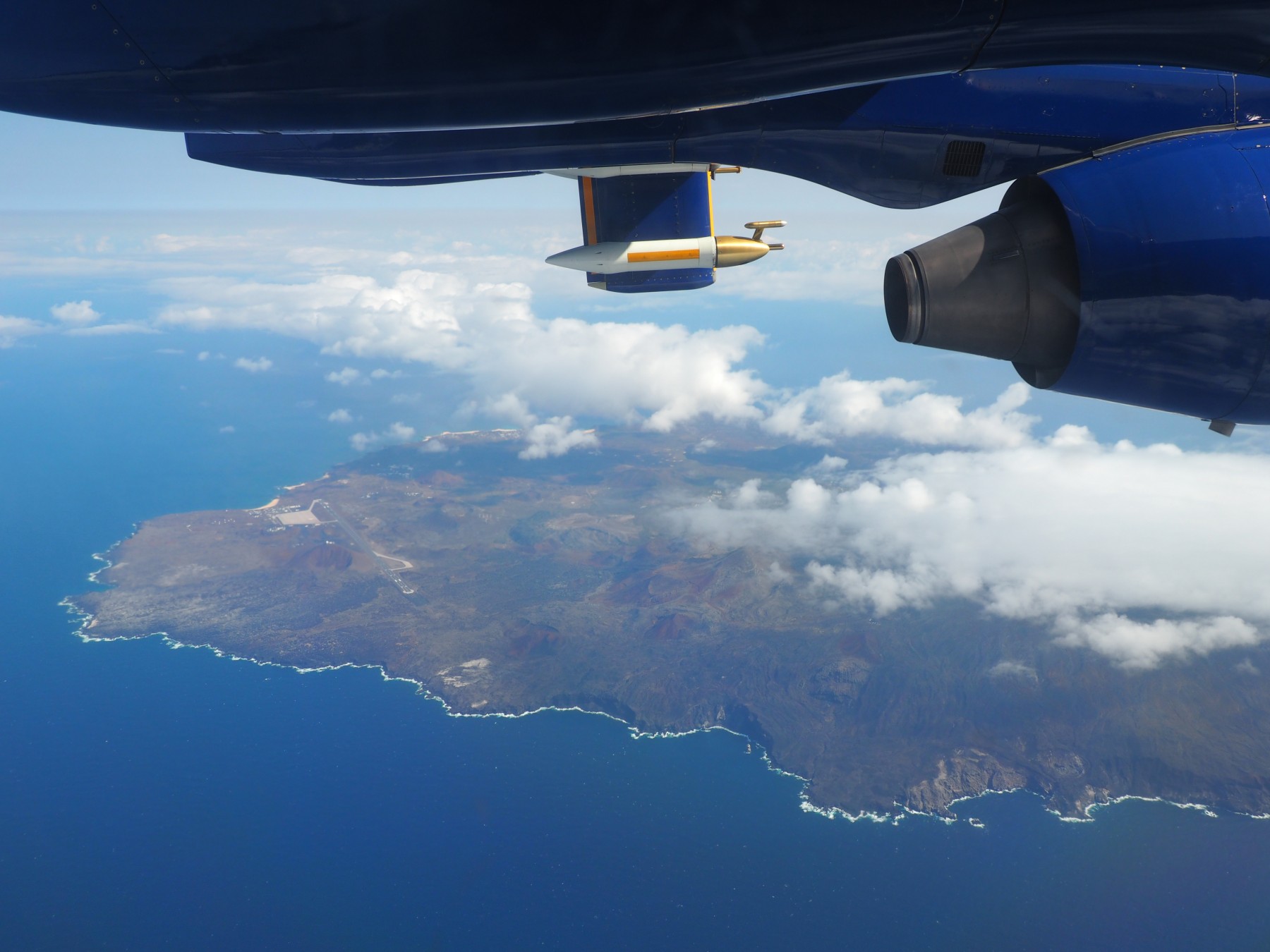
With a configurable scientific payload of up to 4,000 kg, operational altitudes from 50 ft to 35,000 ft, and flight duration of up to 5.5 hours, the flexibility of the FAAM ARA has allowed UK scientists to measure, in the natural environment and in real time, atmospheric constituents, processes, and climatic impacts. Many of these measurements are made for the first time or with increased precision and accuracy using the FAAM aircraft. Measurements have been made of the evolution of clouds under different meteorological conditions, the chemical composition and radiative properties of aerosols, and emissions from aircraft, ships, cities, rainforests, volcanoes, and the ocean.
Climate impacts of biomass burning in tropical regions
In 2014, FAAM joined the US National Centre for Atmospheric Research (NCAR) Gulfstream V aircraft to study the tropical western Pacific troposphere in Guam. The research revealed that carbon monoxide, biomass burning tracers and ozone had strong positive correlations in air parcels with high ozone and low water vapour. The results, published in Nature Communications in 2016, suggest that biomass burning in the remote tropical western Pacific has a larger effect on climate warming than previously thought. This research has an attention score within the top 5% of all research outputs scored by Altmetric, and has been used to support the recommendations made by the Montreal Protocol.
Methane from Arctic seabed does not influence the atmosphere
In Summer 2014, FAAM and the Norwegian Institute for Air Research (NILU) partnered for a project to measure methane (CH4) seepage from the Arctic seabed sediments west of Svalbard, Spitsbergen, funded by the Research Council of Norway. FAAM took airborne measurements at the same time as ship observations of the seabed and water column, and land-based atmospheric measurements. High concentrations of dissolved methane were detected above the seabed, but FAAM’s measurements and computer modeling showed that maximum methane fluxes had limited influence on methane in the atmosphere. This data contributed to major international reports such as the AMAP Assessment 2015, and global estimates, informed policy makers, and was published in 2016 in Geophysical Research Letters, and this research remains significant in the field of oceanic methane emissions, reaching the top 5% of all research outputs tracked by Altmetric.
Globally significant CO2 emissions from Katla, a volcano in Iceland
In 2016 and 2017, FAAM flew over Katla, a highly hazardous subglacial volcano in Iceland that erupted 100 years ago. Working with scientists from the Icelandic Meteorological Office, FAAM’s measurements quantified Katla’s CO2 emissions and showed that it is one of the largest volcanic sources of CO2 on Earth, responsible for up to 4% of total global volcanic emissions.
The results from the Katla study were published in 2018 in Geophysical Research Letters, and its publication Attention Score is in the top 5% of all research outputs scored by Altmetric, confirming its high impact in the field of subglacial volcanism and global CO2 budget research.
The results from the Katla study were published in 2018 in Geophysical Research Letters, and its publication Attention Score is in the top 5% of all research outputs scored by Altmetric, confirming its high impact in the field of subglacial volcanism and global CO2 budget research.
Quantifying methane emitted from tropical wetlands in Zambia
In 2019, FAAM conducted the first airborne measurements of methane (CH4) over three wetland areas in Zambia in the Upper Congo basin. Tropical wetlands are thought to account for roughly one-fifth of the global methane emissions, but studies on tropical wetlands in Africa are extremely rare. The results revealed that the land surface models commonly used to budget methane actually underestimate emissions, meaning that wetlands may be emitting more methane than previously thought. If more methane is being emitted by the many other African wetlands then we may have overestimated the amount of methane that humans can yet emit before reaching 2°C of global warming.
The research output from this study, published in Global Biogeochemical Cycles in 2022, is in the top 3% of papers published in 2022 on this topic in Altmetric.
Long-range atmospheric transport of Saharan dust
Dust from the Sahara and other deserts affects the weather and our climate. During 2011 and 2012, FAAM delivered crucial observations of airborne desert dust as part of the Fennec field campaign in the west African Saharan heat low. This region of the world is poorly represented in forecasting and climate models as few observations have been made in this area (FAAM also flew previously as part of AMMA through the DABEX and DODO campaigns in 2006). One of the highlights of Fennec was the confirmation of the existence, presence and extent of super-coarse (larger than 10 microns) and giant (larger than 62 microns) dust particles measured by FAAM over the Sahara in Mali and Mauritania. Previously it was believed that particles of this size were too large to travel far in the atmosphere but measurements with aerosol and cloud probes confirmed that they were ubiquitous and present up to altitudes of around 5 km. At these heights, they can travel far across the Atlantic.
FAAM dust measurements, reinforced by the ICE-D/AER-D field campaign at Cape Verde in 2015, provided further evidence that super-coarse dust particles exist within dust plumes in the atmosphere, and are missing in weather and climate models, which affects our ability to predict dust plume transport and the contribution of dust to climate change, since larger dust particles are able to cause more of a warming effect than smaller ones. This has led to a deluge of model investigation and improvement studies to understand how we can improve dust in weather and climate models using observational airborne data and understand their deficiencies, much of which is still ongoing.
Understanding the Earth’s nitrogen cycle
Between 2019 and 2022, the FAAM Airborne Laboratory flew in the clean marine atmosphere over the North Atlantic Ocean as part of the North Atlantic Climate System Integrated Study (ACSIS) project, taking measurements during different seasons. Our measurements confirmed that the ocean is a significant source of gas-phase urea. The study was published in 2023 in Proceedings of the National Academy of Sciences, and the results have significant implications for our current understanding of the global nitrogen biogeochemical cycle, which is essential for plant growth and crop yields. The attention score of this research paper is in the top 5% of all research outputs ever tracked by Altmetric.
Aerosol impacts on climate and cloud processes
Atmospheric aerosols and their interaction with clouds, despite improvements in the period between the Intergovernmental Panel on Climate Change (IPCC) Assessment Report (AR) 5 in 2014 and IPCC AR6 in 2021, are still responsible for some of the largest uncertainties in climate models. Observational measurements are still essential to improve climate models. In 2017 the FAAM aircraft flew out of Ascension Island in the Atlantic Ocean, working in collaboration with French airborne, and US ground and airborne campaigns to quantify the impacts of biomass burning aerosols, improve climate models, and calibrate satellite measurements. These measurements have also been used to develop better predictions about the impacts of aerosols on the climate.
There continues to be an urgent need to understand how aerosol particles influence clouds, and for climate models to replicate these processes accurately. FAAM’s work has a real world impact, contributing directly to the implementation of the advanced Cloud and AeroSol Interacting Microphysics (CASIM) scheme in the Met Office Unified Model.
A landmark study in 2011 synthesized organic aerosol measurements from 17 aircraft campaigns between 2001 and 2009, including by FAAM. It provided the first comprehensive evaluation of global model performance against vertical organic aerosol distributions. The study found that models systematically underestimated observations in 13 of 17 campaigns. FAAM’s vertical profiling capability was crucial in showing that model bias increased with relative humidity and that additional sources and sinks were required to match observed organic aerosol concentrations.
Turning Airborne Measurements into Societal Impacts
 Sampling the exhaust plume of a cargo ship off the coast of Portugal during the ACRUISE campaign, 2019. Image credit Graeme Nott.
Supporting Met Office climate and weather models
FAAM observations have been critically important to Met Office weather and climate modelling. Measurements of atmospheric phenomena allow for their parameterization and inclusion in ever more sophisticated and accurate models. Measurements from the FAAM aircraft have led to improved cloud and precipitation parameterizations of raindrop fall speeds, autoconversion of cloud droplets to precipitation, mass-dimension relationships of cirrus ice particles, shear-driven boundary layers and ice-cloud fraction in mixed phase clouds during cold air outbreaks. All of these parameterizations are being used operationally in Met Office models. A new surface exchange scheme for the transition region between sea ice and open ocean was developed from ACCACIA campaign measurements. Integrating this into their models the Met Office said “…this parameterization led directly to a significant improvement in our weather and climate prediction modelling systems locally and globally…”. This dataset is being used by other global forecasting agencies to implement similar parameterizations.
Recently, multiple FAAM field experiments have supported the development of the new Met Office Cloud Microphysics scheme, CASIM. In situ data from FAAM projects that evaluated cloud microphysics, aerosols, and dynamics heavily underpinned the model development, including COPE, VOCALS, DCMEX, PICASSO, CLARIFY, and ACAO/M-Phase. These projects were supported by FAAM across 15 years from 2008 to 2022. The Met Office considers CASIM part of a world-leading development that has produced a measurable improvement in both global and UK model forecast performance scores.
An independent study concluded in 2024 that the Met Office will deliver benefits worth £56 billion to the UK economy over the next ten years. Improvements to model accuracy have had material benefits and are constrained and verified by measurement data, many of which are from FAAM observations. In recognition of this, the Met Office and UKRI are currently running the ParaChute program to improve the representation of atmospheric turbulence in forecast models. FAAM flew the WesCon and associated WOEST campaigns over the UK southwest in 2023 in synergy with the Chilbolton observatory, UAV’s, and ground-based measurements.
Thirteen FAAM projects across a decade combined to underpin the Global Aerosol Synthesis and Science Project (GASSP). This initiative was noted in the 2021 Research Excellence Framework as being instrumental to the development of the Global Model of Aerosol Processes (GLOMAP) aerosol scheme. GLOMAP is a key component in the UK Earth System Model (UKESM1) and contributes to the World Climate Research Programme’s Coupled Model Intercomparison Project (CMIP6), which informs international climate policy.
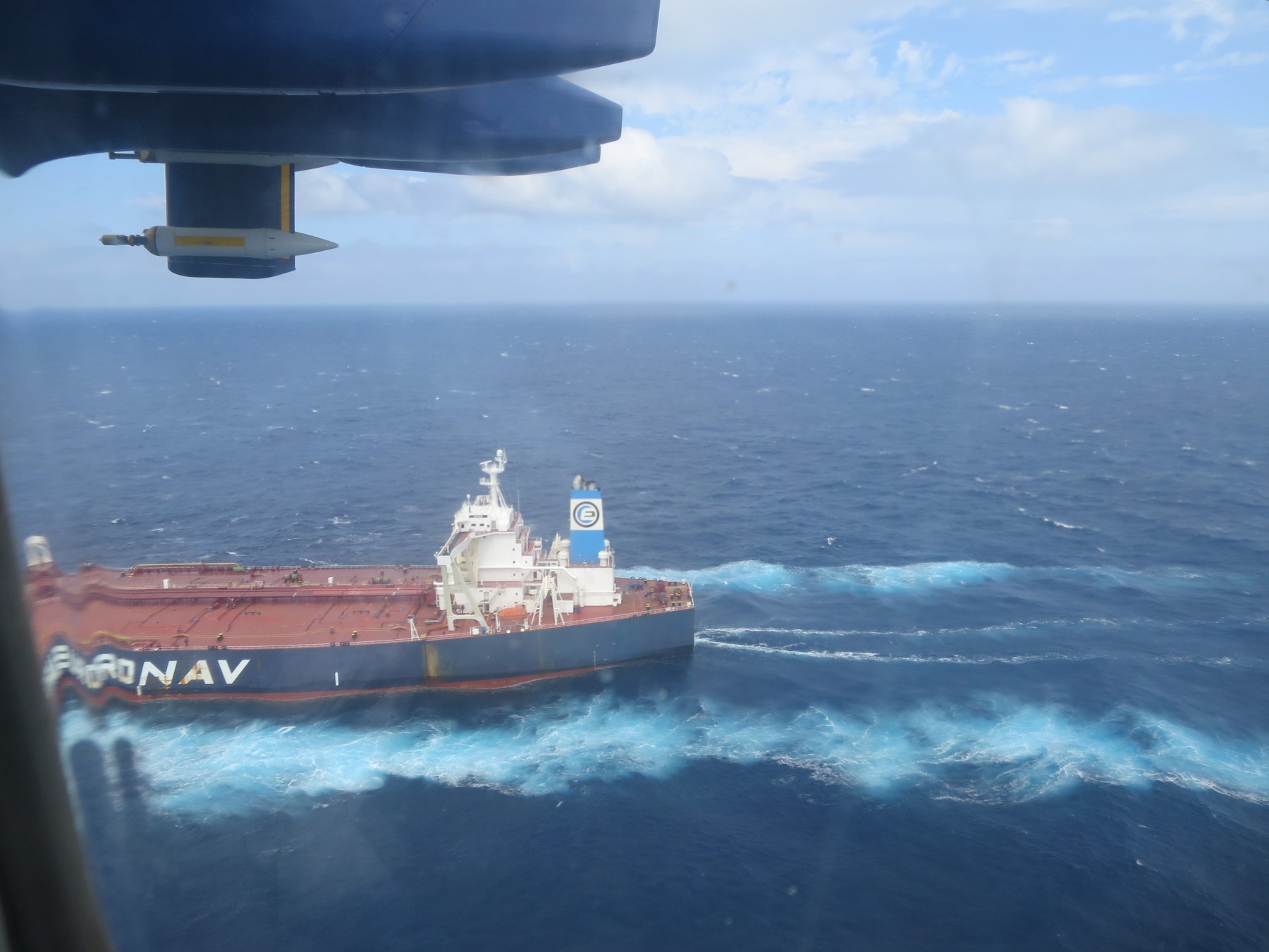
Shipping emissions and the impact of international regulations
In 2020, international maritime regulations were introduced to significantly reduce the amount of sulphur allowed in ship fuels. FAAM measured the impact of, and compliance with, these new limits during the ACRUISE campaign. FAAM flew in the eastern Atlantic and English Channel in 2019, before the restrictions came into force and afterwards in 2021 and 2022. Prior to 2020, pollutants and cloud condensation nuclei fell by approximately a factor of 5 across the sulphur emission control boundary. After 2020, a ten-fold decrease in sulphur emissions was seen in open ocean shipping lanes while the proportion of ships exceeding regulatory limits also dropped by a similar proportion.
Emergency Response and Civil Contingencies
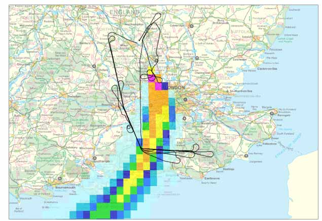
Flight track of B149, 13 December 2005, and modelled plume from the Bruncefield oil depot explosion [source DEFRA report AEA/ENV/R/2168 Issue 1].
2005 Buncefield oil depot fire
In December 2005 several oil tanks at a storage depot near Hemel Hempstead exploded. The resulting smoke cloud rose to over 2,000 m in height and drifted across Hertfordshire, Bedfordshire, and further to the South West. FAAM flew into the smoke plume to map its spatial extent and determine chemical and physical properties of the smoke constituents. Emission estimates were calculated and used to initialise the Met Office plume dispersion model. Offline analysis of toxins was carried out to determine potential public health impacts.
2010 Eyjafjallajökull Volcanic Eruption
In April 2010 the Eyjafjallajökull volcano in Iceland erupted, shutting down airspace across much of Europe and impacting flights globally. Equipped with in situ particulate and gas phase instrumentation as well as lidar for remote measurement of the ash cloud vertical structure, the FAAM aircraft was able to safely operate in ash-contaminated airspace over the North Sea and UK providing data unavailable from any other terrestrial platform during the Eyjafjallajökull crisis. The CAA and Met Office used this data to map the evolution of the ash cloud and decide when and where to reopen UK airspace and to improve resilience to future such events.
2012 Total Elgin platform gas leak
In 2012, FAAM was deployed to measure an uncontrolled gas leak on the Elgin gas platform in the North Sea. We measured the methane flow rate during six flights over a three week period, within five days of the initial wellhead blowout on 25 March. Our measurements were used to confirm the changes to the leak (both total flowrate and composition), allowing Total’s relief engineers to reoccupy the platform and begin plugging the leak. The well intervention operation began on 15 May, and the leak was stopped 12 hours later. At Total’s request, FAAM undertook one further flight on 15 August to independently confirm that there were no residual emissions from the Elgin platform. FAAM’s services were praised as “the most robust and valuable of all” by Total and the then Department of Energy & Climate Change. The cost of the two-month shutdown was £1 billion, and FAAM’s work was highlighted as a factor that limited the duration of the incident.
Responding and preparing for threats
Similar disasters in the oil and gas energy sector required airborne responses both on- and off-shore, such as the Gulf of Mexico Deepwater Horizon oil spill in 2010, the Aliso Canyon blowout in Los Angeles in 2015, and the Nord Stream gas pipeline sabotage in the Baltic Sea in 2022. For the 2022 Nord Stream underwater pipeline explosions, a report from the United Nations Environment Programme International Methane Emissions Observatory (UNEP/IMEO) showcases the importance of different measurement approaches, marine, airborne, tall-tower and satellite- based, for quantifying methane emissions in similar contexts.
The FAAM Airborne Laboratory is the only European research aircraft to have taken part in the first peer-reviewed assessment of methane measurement technologies in Europe. FAAM’s aircraft sampled a methane controlled release conducted in Lacq (France) in September 2024, supported by Stamford University under the auspices of TotalEnergies and the UNEP/IMEO, to validate detection and quantification capabilities. FAAM successfully detected and quantified an on-shore methane release, the results of which are currently being peer-reviewed.
Sustainable Aviation Fuel: a UK-first experiment
The FAAM aircraft was among the first in the UK to operate routinely on Sustainable Aviation Fuel (SAF) and has been involved in several projects to understand the impacts of SAF on both the environment and the aircraft using this type of fuel. The most recent of these, GRound-Based and Inflight Measurements of Sustainable Aviation Fuel (GRIM-SAF), was the first instance of an aircraft “chase” experiment in the UK; flying in close formation with another aircraft with the aim of sampling its exhaust plume multiple times throughout a flight.
Partnerships
Satellite validation with the European Space Agency
Validation and/or calibration of satellite retrievals involves the comparison of direct in situ measurements with comparable data derived from the satellite remote sensing data. FAAM has long been involved in this type of work. In fact EAQUATE, a validation campaign of the Atmospheric Infrared Sounder (AIRS) on the then recently launched NASA Aqua satellite, took place in September 2004 just 6 months after the first FAAM flight. Flights were carried out in conjunction with the Scaled Composite Proteus aircraft. Further flight campaigns have been flown as new satellite instruments have been launched. The Joint Airborne IASI Validation Experiment (JAIVEx) was designed to validate the performance of the IASI instrument on MetOp satellites using FAAM and the NASA WB-57. Installed on the FAAM BAE 146, the ARIES hyperspectral infrared sounder provided high‑spectral‑resolution nadir infrared radiances closely matched to the satellite instrument. This enabled assessment of IASI radiometric accuracy and testing of the radiative transfer algorithms used to calculate temperature and humidity profiles from the satellite measurements.
Jumping forward a decade and FAAM continues to prove its value for the satellite industry. The EARTHCARE satellite, launched in 2024, includes instruments for the global profiling of clouds and atmospheric aerosols. To validate cloud retrievals with in situ cloud particle measurements, FAAM conducted flights over the UK in 2024 and 2025. A variety of cloud types were selected with the ARA flying at multiple altitudes to fully characterise the vertical cloud structure. Timing and location were precisely controlled so that the aircraft was in a prime part of the cloud field and directly underneath the satellite as it went overhead. This work has already resulted in improvements to the ECMWF weather forecasting model and future validation campaigns for the European Space Agency (and funded by them) were in the planning stages.
Monitoring Monsoons in India
In 2016, FAAM went to India with 50% funding from the Ministry of Earth Sciences as part of a multi-agency campaign to study the Indian Monsoon. The aircraft was stationed in the northeastern city of Lucknow, prior to the arrival of the Monsoon, in Bangalore in the south at the start of the Monsoon, and back in Lucknow during the monsoon season in July. Flights covered much of the country and surrounding seas in a range of meteorological conditions. This was part of an ongoing UKRI-India partnership programme.
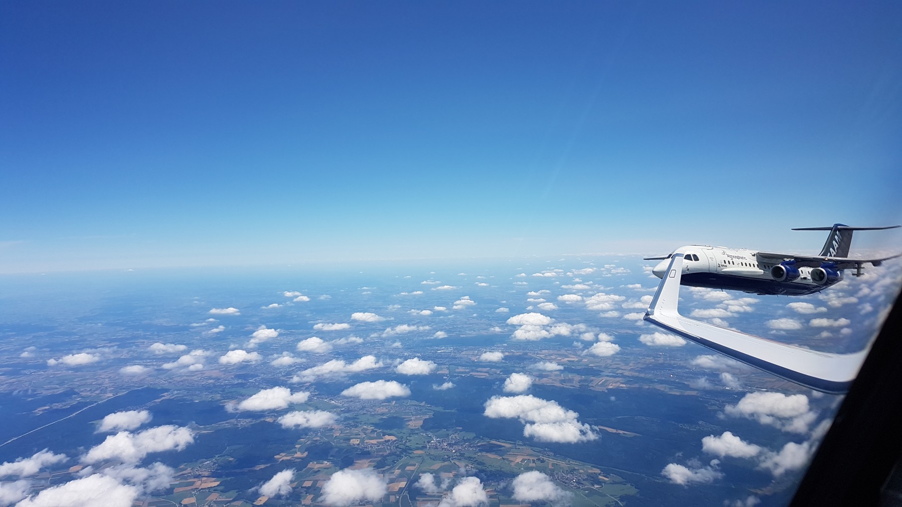
Wingtip-to-wingtip measurement comparisons
In 2017 FAAM flew to the DLR airfield at Oberpfaffenhofen, Germany, to take part in the International Conference on Airborne Research for the Environment (ICARE-2). The DLR HALO aircraft was taking part in the EMeRGe European campaign at the time so this provided an ideal opportunity to compare airborne measurements from two aircraft side by side. Rigorous planning and briefings between the pilots of both aircraft were required for flying wingtip-to-wingtip with separations in the tens of metres. Detailed comparisons were made of 28 parameters measured simultaneously on both aircraft and this, for example, resulted in a more robust understanding of the uncertainty of static pressure measurements on the FAAM aircraft.
Aggregated aircraft measurements can provide an invaluable source of data for global studies. For example, in situ cloud data from multiple aircraft campaigns is used to quantify satellite cloud droplet concentration retrievals and optimise satellite sampling strategies, in situ CO2 measurements over 10 campaigns have been used to construct Southern Ocean air-sea CO2 flux as a function of latitude and season, and 17 aircraft campaigns were used to assess the skill of the GEOS-Chem model in determining the vertical structure of organic aerosols around the globe. These meta-studies may be carried out many years after the flying is complete so an understanding of the accuracy and uncertainty of the same measurement made across different platforms is imperative. FAAM has carried out many such comparisons, for example with the NASA P3 in the Atlantic Ocean and as part of the International Consortium for Atmospheric Research on Transport and Transformation (ICARTT) in 2004.
Public Engagement and Science Development
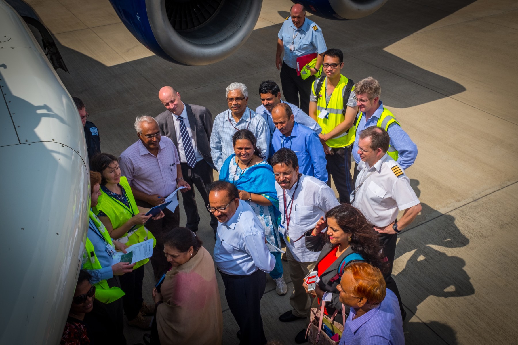
Dignitaries, including the Minister of Earth Sciences, the Secretary of Ministry of Earth Sciences, and the British Deputy High Commissioner, have a tour of the FAAM aircraft while at Lucknow airport during the INCOMPASS/SWAAMI field campaigns in 2016. Image credit Steve Devereau.
Training Future Atmospheric Scientists
Each year since 2015 FAAM has hosted a Masters of Chemistry student with the University of York. This placement allows students to gain firsthand and practical experience in atmospheric chemistry; instrumentation, measurements, and data processing as well as being part of the FAAM team on flying campaigns. All past students are taking or have received a PhD and remain working in the field. In 2017 FAAM took part in the EUFAR STANCO training course that was hosted by the University of Cambridge. Twenty students from around Europe attended and, along with coursework, planned and flew a mission on the FAAM ARA.
In 2023 FAAM started the Research Runway scheme which offered early career researchers and those new to the field the opportunity to test their scientific ideas. Training in airborne measurements and flight planning were provided along with 10 hours of flying from Cranfield at no cost. Three applications were accepted from the resulting submissions with the successful projects looking at the influence of natural electric fields on cloud formation, methane emissions from Scottish wetlands, and air pollution in the Birmingham area.
Publicising UK Science
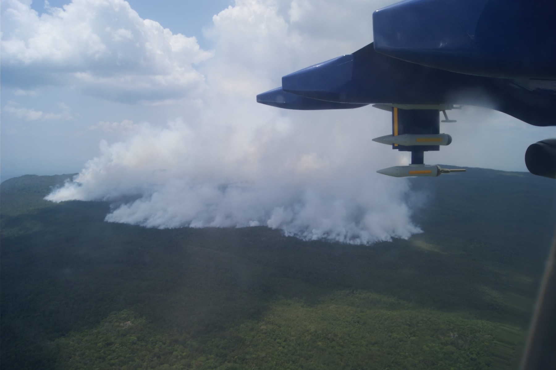
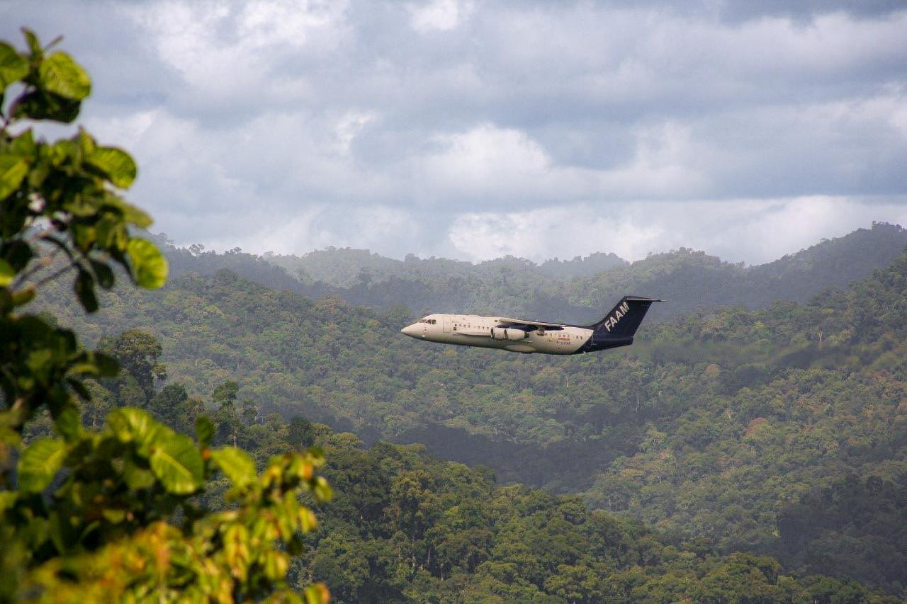
The FAAM Airborne Laboratory has flown to many regions of the world, taking measurements that increase our understanding of atmospheric constituents and processes and benefit the UK and global populations. When abroad we work with local government departments, research organisations and universities, airports and handling companies, and suppliers of various types. We give aircraft tours and lectures to colleagues we are working with. This is science-based soft power. FAAM became the first large international atmospheric research aircraft to successfully conduct a measurement campaign over the Brazilian Amazon. Years of planning paid off with a globally-significant dataset which illustrates the importance of specialist skills in campaign planning. A number of subsequent international aircraft campaigns have added to that dataset after FAAM paved the way in 2012.
The media has reported from the FAAM aircraft on numerous occasions and interviewed FAAM staff. BBC News joined flights in 2012 and 2016, both of which were looking at atmospheric dynamics in order to improve weather models. ITV News, as part of their ‘Clearing the Air’ series, flew on a test flight before the aircraft left for Cape Verde to study ice nucleation effects of desert dust. GoodTV produced ‘Storms from Space’ for Channel 5 with footage from staff interviews and a flight in late 2024.
In 2012, 2014 and 2024 FAAM exhibited at the Royal International Air Tattoo, offering the public a rare opportunity to see the aircraft up close and talk to our team directly. We have also exhibited at Prestwick Air Show, Farnborough International Air Show, UKRI’s Festival of Tomorrow, and NERC’s Into the Blue and appeared at several others.
Members of our team deliver talks, training and workshops to schools and universities, professional bodies, and other research institutes. Most recently, in 2025 Dr. Oleg Kozhura (Science Delivery Coordinator for the MLU) represented FAAM Airborne Laboratory in the “I’m a Scientist, Get me Out of Here” student-led STEM enrichment activity. To date Oleg has supported 21 live chats with school students of different ages. Oleg won the award for most-voted-for scientist in July 2025.